GEOROC 2.0: Long-Used Database Gets an Upgrade as ERW Research Soars
GEOROC 2.0 Database Logo from the Helmholtz Centre for Geosciences website
Before researchers and startups can discuss large-scale implementation of enhanced rock weathering (ERW), they have to understand their rocks. The capacity to capture enough carbon to offset mining operations, the ability to minimize environmental pollutants, and the ability to predict impacts of remineralization on soil communities can all be elucidated by good geochemical data. Standing prominently in the field with over 25-years of service is the Geochemistry of Rocks of the Ocean and Continent (GEOROC) database, an online resource hosting published analyses of rocks and minerals from locations across the globe. Formerly maintained by the Max Planck Institute for Chemistry in Mainz, Germany, the database has amassed over twenty-thousand papers, six-hundred-thousand samples, two-million analyses and thirty-million single data values in more than 20-years of operation. Since its inception, the database has been gathering isotopic ratios, rock ages, geospatial information, and other metadata submitted by researchers across the globe.
With stewardship of the database now transferred to the Digital Geochemistry Infrastructure (DIGIS) team at the University of Göttingen, improvements to data consistency and accessibility are underway to further improve data infrastructure that lies behind many innovative geological studies. The DIGIS team currently operates out of the Department of Geochemistry and Isotope Geology at the Geoscience Centre (GZG) and is composed of specialists, developers, coordinators, data scientists, curators and assistants. In their introduction of GEOROC 2.0, authors indicate the team is working to modernize data infrastructure based on pre-established pipelines used by other databases.
Over 20-years of Service
GEOROC was first developed in 2000, when it joined the Petrological Database of the Ocean Floor (PetDB), a similar database founded in 1995 under the EarthChem group at the Lamont-Doherty Earth Observatory in Palisades, NY. At that time, the EarthChem Portal (ECP) emerged as an integrated source housing GEOROC, PetDB, and to date, four other databases accessible to researchers worldwide. GEOROC alone has nearly doubled the number of archived samples since 2008, demonstrating its continued importance within the geological community and its significant contribution to the online maintenance of geological data.
Since its start, GEOROC has been referenced in thousands of publications and used as a resource for crossdisciplinary research, from machine learning models elucidating 3.7-billion-years of Earth history to creating open source tools to help researchers understand volcanic eruptions. And while GEOROC’s most obvious implications are for academic work in fields such as geology, natural history, or even planetary dynamics, geochemical metadata also plays a role in carbon capture research and implementation, especially for ERW.
ERW as a carbon capture technique typically involves the sourcing, crushing, and spreading of rock dust onto large plots of land. The idea is that by speeding up the Earth’s slow carbon cycle with rock dust, we can sequester carbon in the ground. As an added bonus, rock dust applied to agricultural land has been shown to help increase crop yields, making ERW an environmentally and financially promising solution. However, before large-scale projects can be implemented, feasibility data must be collected to evaluate the ability to sequester substantial amounts of carbon, the impacts to the soil ecosystem, and the potential release of elements that can pollute the environment (such as heavy metals).
These dynamics can become extremely complex. Studies demonstrate the impact of geochemistry on ERW implementation: the composition of both the rocks used for rock powder and the soil profile are key components affecting efficacy.
Easier access to geochemical data is then a powerful tool in improving predictive power and moving projects from idea to reality. Through data modeling, researchers can assess carbon storage potential in rock formations and use geospatial data to source rocks, evaluate weathering rates, or predict which minerals will be released into the soil and their impacts. Overall, robust datasets provide an efficient way to pull insights about how a carbon capture program may work and what pitfalls may occur, which makes databases like GEOROC vital. While the database is well established, the upgrades underway stand to improve data quality and integration between data sets.
GEOROC Datasets and Upgrades
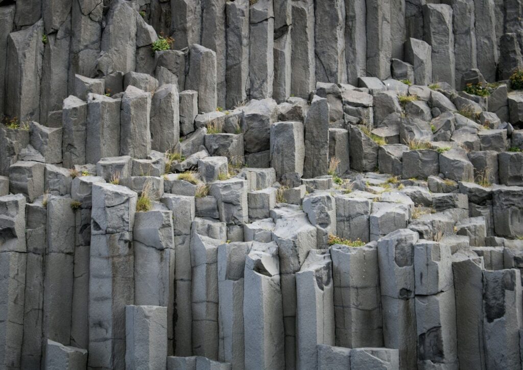
GEOROC primarily contains data on metamorphic and igneous rocks, such as gneiss and basalt, as well as mineral and inclusion data. In April of this year, some key updates to part of GEOROC 2.0 were presented at the European Geosciences Union (EGU) General Assembly conference. First, a new API and interface has been developed to enhance user accessibility within the database. A new data model was also devised to ensure standardized vocabulary and industry consistency, which should improve data quality and increase interoperability with other databases housed under ECP.

As explained in the abstract to the presentation, GEOROC aims to deploy “a feature-based data model compatible with the OGC Observations and Measurements standard and controlled, machine-readable vocabularies that harmonize geospatial, analytical and sample-related metadata, and enabling seamless integration in multiple databases and portals (e.g., EarthChem).”
Connections between these databases was a key point reinforced several times during the update process. The GEOROC team further explained in the article that the collaboration between EarthChem and DIGIS, “integrates with the international OneGeochemistry initiative to create a global geochemical data network that facilitates and promotes discovery and access of geochemical data through coordination and collaboration among international geochemical data providers, in close dialogue with the scientific community and with journal publishers.”
And while this integration was a notable first step, in a 2025 conference paper the team indicated that full integration was still a missing link in the current data ecosystem, despite the consolidation provided by the ECP.
As part of the interoperability and accessibility effort, the DIGIS team is also working with GFZ Data Services to assign digital object identifiers (DOIs) to data, and to standardize nomenclature, reporting, and data entry. These updates will enable users to more quickly collect, cite, and submit data to the open access platform as well as aid compliance with the findable, accessible, interoperable, reusable (FAIR) data principles the databases were founded on.
FAIR databases like GEOROC offer several benefits. Robust metadata requirements makes information easier to search for and find via human or machine, and ensures that the same dataset can be reused for multiple applications. To ensure the pipeline remains complete, GEOROC has published guides on what constitutes metadata completeness and will continue to make improvements to the entry process as part of the GEOROC 2.0 updates.
Updated Databases Support ERW Research
The updates to GEOROC are an exciting development for geoscientists and represent an improved pathway for research into rock-based carbon capture methods. In addition to housing data that can help to elucidate geochemical cycles on earth, the database allows researchers interested in carbon capture to draw insights using data modeling, an increasingly powerful tool to evaluate ERW.
In a December 2024 research paper published in the Journal of Advances in Modeling Earth Systems, authors described the many uncertainties encountered when evaluating ERW. Most unanswered questions stem from the level of complexity that soil and rock interactions possess, in addition to the lack of integrated data to make meaningful comparisons. To combat this, authors developed a soil model for ERW factoring in ecology, hydrology, and geochemistry using comprehensive soil data. The model could be used to not only carry out varying ERW scenarios, but also to replicate experimental data and clarify long held assumptions about the ERW process. Combined with mineralogical metadata, improved models could further elucidate longstanding questions and blind spots currently facing ERW researchers.
Even outside of the scope of data modeling, GEOROC has already proven to be a valuable resource for ERW researchers. In 2024, data pulled from GEOROC was referenced in a case study aiming to quantify ERW. Using several data sets, including composition data for basalt and peridotite pulled from GEOROC data, they developed a framework to monitor sequestration of CO2, distinguish applied rock dust from background soil, and evaluate if a mass balance approach could be used to track weathering and sequestration.
In 2025, GEOROC datasets were involved in a study evaluating the potential for kimberlite residues from historical diamond mines to meet the rock sourcing needs of ERW projects. A combination of control plots with applied kimberlite residues, as well as soil and rock metadata was used to evaluate quantification methods and determine carbon removal rates.
Outside of academia, the organization UNDO Carbon, a company currently removing atmospheric carbon through rock dust applications on agricultural land cited GEOROC as a key part of their technological toolkit.
As updates to GEOROC continue, the long-used database will be better able to serve carbon removal projects and will exist as an improved part of the global geological data ecosystem, providing additional resources for scientists, new insights into Earth’s geochemistry, and added opportunity for interdisciplinary collaboration.
Bayleigh Murray is an environmental data analyst and science writer based in Oregon, U.S.A. She has a research background in microbial ecology and a professional background in environmental assessments. She holds a B.S. in Molecular & Cellular Biology and Earth & Planetary Sciences from Johns Hopkins University and has written and edited popular science features for the Johns Hopkins News-Letter and the Triple Helix Science and Society Review. She is an avid blogger and is passionate about exploring the intersections of science and culture.
Support us on Patreon
Thank you for joining us today! Please become a member of RTE and support us on Patreon. Unlike many larger organizations, we work with a team of determined and passionate volunteers to get our message out. We aim to continue to increase the awareness of remineralization to initiate projects across the globe that remineralize soils, grow nutrient dense food, regenerate our forests’ and stabilize the climate – with your help! If you can, please support us on a monthly basis from just $2, rest assured that you are making a big impact every single month in support of our mission. Thank you!


Got something to say?